Redundant rails - Dover to Vredefort
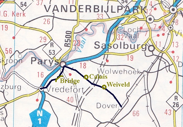
 The line is (was) a branch line coming off the main line Johannesburg - Bloemfontein at Dover station and going west to Parys and Vredefort. Distances from Dover to Parys 32 km and Parys to Vredefort 16 km.
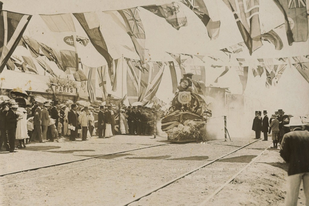
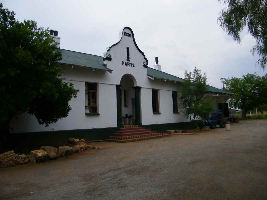
The line up to Parys was opened on the 22 Dec 1905, see picture on the right. On the station building in Parys it says 1930, this would be the year the station building was erected.
Looking at a map from the 1930th I notice that at that time the rail only went as far as Parys, the link to Vredefort must have come later.
The stations in sequence coming out of Dover are Weiveld, Calais, Parys and Vredefort.
Dover station
27.05785°S, 27.72487°E, 1488m
 The rail to Vredefort branches off here. This station is still active, actually not. It used to have a control center, all this has now been centralised and the switching is done remotely from Wolvehoek. The trains are still rolling through, but they don't stop.
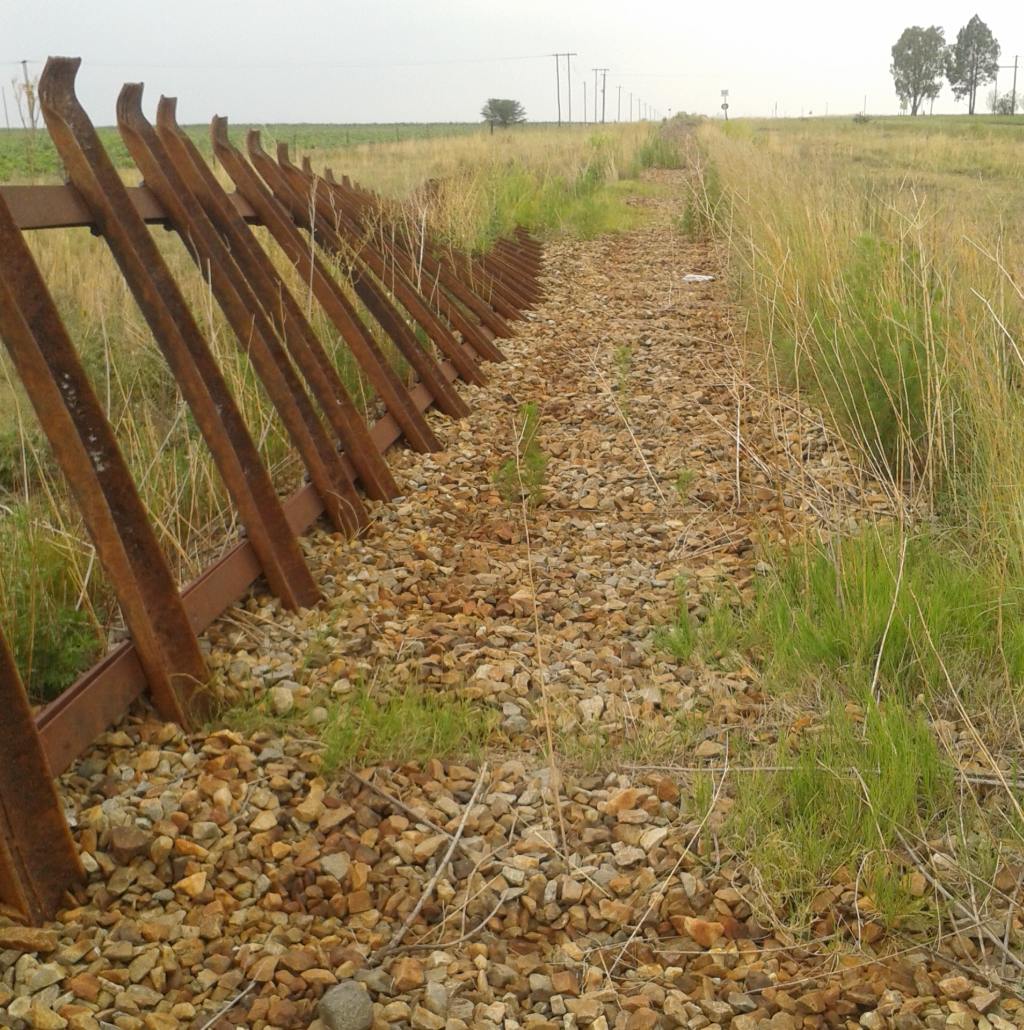
Coming out of Dover station there is a place where the whole rail has been lifted and overturned. We could not figure out what has been going on here? If the intention was to steal the rails then surely its the easiest to unscrew them to take them away.
Weiveld station
26.97157°S, 27.6181°C, 1480m
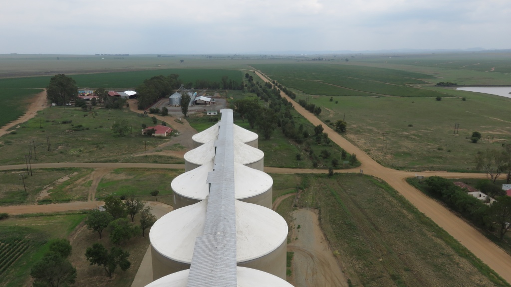 The view from the top of the silos is towards Parys and showes the flatness of the Free State. What used to be the Weiveld station is just over the road and to the left of the road to Parys. A branch also served the silos, hardly recognisable now. The rail to Parys runs parallel and to the left of the road. Also in the picture is the General Dealer store with one of the petrol pumps still standing. The shop is no more, it closed down after they had an armed robbery a while ago. The building has been partially gutted.
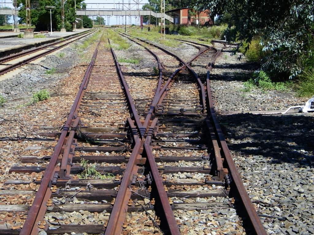
Parys station
26.90657°S, 27.46554°E, 1411m
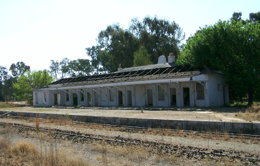
 The lines may have been laid in 1905, but the station building as it stands today was only built in 1930. When we first got to the station in around 2008, the building was partially destroyed , window frames removed, some of the roof sheets gone and the ruin full of rubbish and shit (literally). Fortunately the building was taken over by a rail construction company, the place got refurbished and is being used as the head office of the company.
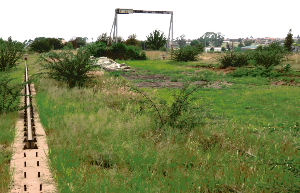
 One of the main activities at the station was loading of granite blocks from the quarries in the area. The rail in the foreground was one of the rails of a overhead crane. The frame in the back could have been for the same purpose or more likely for container handling.
Also still on the station is the water supply point for the steam locomotives.
Vredefort station
27.00679°S, 27.37379°E, 1413m
 What comes to mind here is: 'Endstation, alle aussteigen', that was the call when in my youth I used the train, arriving at the last station: 'last station, all disembark'. This is the case with Vredefort, it is the last station on the line.
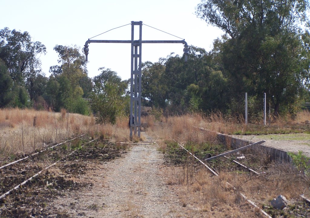
On the picture the station building and ticket office are in the back on the left. It is now used as a shop (cafe). The goods shed is on the right (behind Colin). The rails also served the silos, all this bulk transport is now on the road.
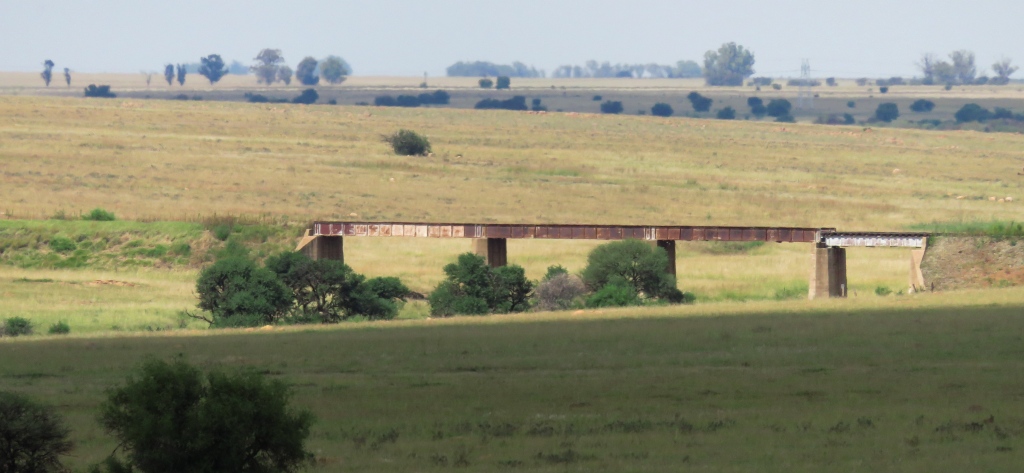 Between Parys and Vredefort is the bridge over the Skuilpspruit. Along the route the most major structure. The bridge was inspected a while ago for a possible re-opening of the line. It is still intact and the rails are still in place, although closer to Vredefort, apparently, a few kilometers of rail have been stolen.
I could not find a name plate or any other indication of the age of the structure. The pictures were taken during a visit in April 2016.
References
Ref 1.: Standard Encyclopedia of Southern Africa, Nasou Limited, 1974